The community improvement district (CID) was planning to reconnect two sides of the thriving Buckhead district of Atlanta, Georgia, with HUB404, a planned 9-acre, half-mile greenspace that will span the GA 400 highway and link the nearby pedestrian way and two MARTA transit stations.
Planned amenities include common areas, an amphitheater, a plaza and gardens. Concepts call for a swirling design that braids above the highway with areas open to the roadway below. Once completed in 2025, it will be the first transit-oriented park in the country. The project was in the early planning phases and was moving into fundraising. Before that could occur, the Buckhead CID contracted KCI to gather critical data on property boundaries, utilities and topography in order to take early visions to the next phase of development. The objective was to create a database of all survey information needed to advance the design.
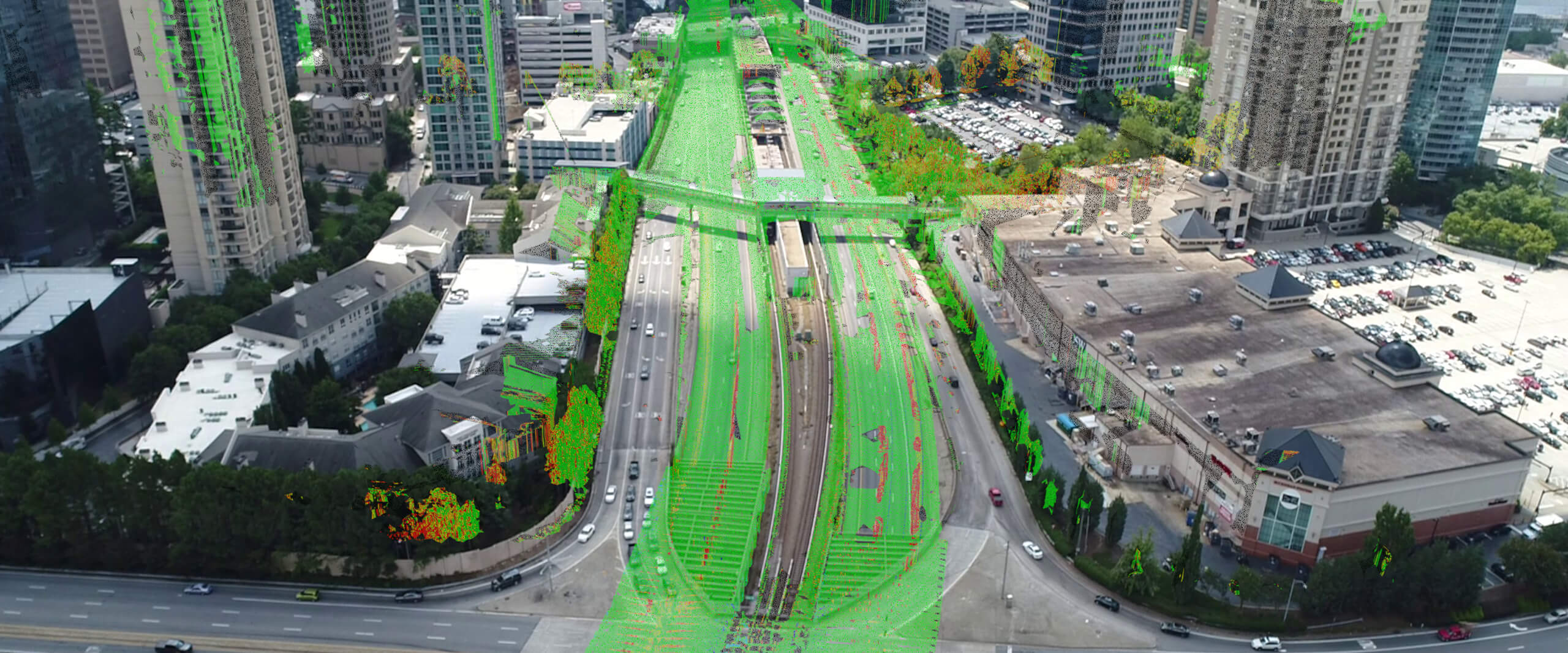
MicroStation and InRoads were selected for this project to provide the client with the highest quality 3D product that is compatible with GDOT standards and other transportation data. A comprehensive dataset was developed to support conceptual plans as well as the final design and construction. In addition, by taking advantage of the LumenRT integration with MicroStation, the team was able to create inspiring graphics of the original base HUB404 concept. The proposed site boasts a congested mix of freeway flanked by upscale retail, commercial and residential districts. Data was required for an extraordinary number of assets that would have to be considered as part of the proposed park footprint. This project utilized cutting edge technologies of 3D terrestrial, aerial and mobile LiDAR scanning, and incorporated high-resolution photography collected by drones to acquire data inside and along one of the most traveled corridors in the State of Georgia.
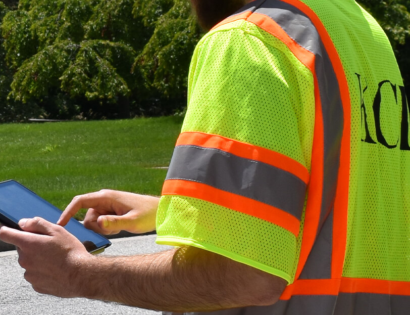
This approach enabled KCI to collect data efficiently, preventing unneeded dangers to workers on the ground while minimizing lane closures or traffic control. Utilizing LiDAR technology, KCI collected the majority of walls, lanes, columns, roadway profiles, and ramps in the safest way possible. Survey control was established utilizing survey-grade GLONASS based GPS, again minimizing the time required near the roadway to establish the horizontal and vertical values. Our team coordinated with design engineers and concentrated on assembling the database in the areas established as the highest priority. KCI collected a majority of previously marked SUE locations utilizing a drone (UAS) with an onboard HD camera to capture orthophotography. A specialized drone easily maneuvered around buildings to collect aerial photos of marked subsurface and above ground utilities. This approach allowed us to collect the physical markings before they were obliterated by traffic or washed away by the weather. The orthophotography served as the main resource to use in drafting the individual utility lines and provided an excellent source of QA/QC after the final mapping was produced.
The visualization component made the HUB404 project truly unique and sets the table for future detailed concepts of this exciting and creative approach to urban land development. The LumenRT rendering engine is incredibly fast and delivers highly realistic renderings. The integration of LumenRT into MicroStation worked well, and the team delivered visualization products including video flythroughs that communicate the inspiring nature of this urban park concept.
The videos helped solidify the brand framework and created a platform for sharing project goals and proposed amenities. Lush plantings that will combat the heat-island effect, native flora requiring minimal maintenance, and safe and easy access to the park are illustrated in visual fly throughs as pedestrians and visitors enjoy what will become an urban destination. The park is planned as a key community identifier, reconnecting a fragmented commercial and residential district, spurring development and more than 17,000 new jobs, and increasing property values up to an estimated $2.5 billion.